
Krakow walking tour map: an original self-guided route
Follow this Krakow walking tour map from the Barbican toward Wawel. Use eight text stages, shorter routes, source notes and current access checks.
Eight-stage Old Town walk
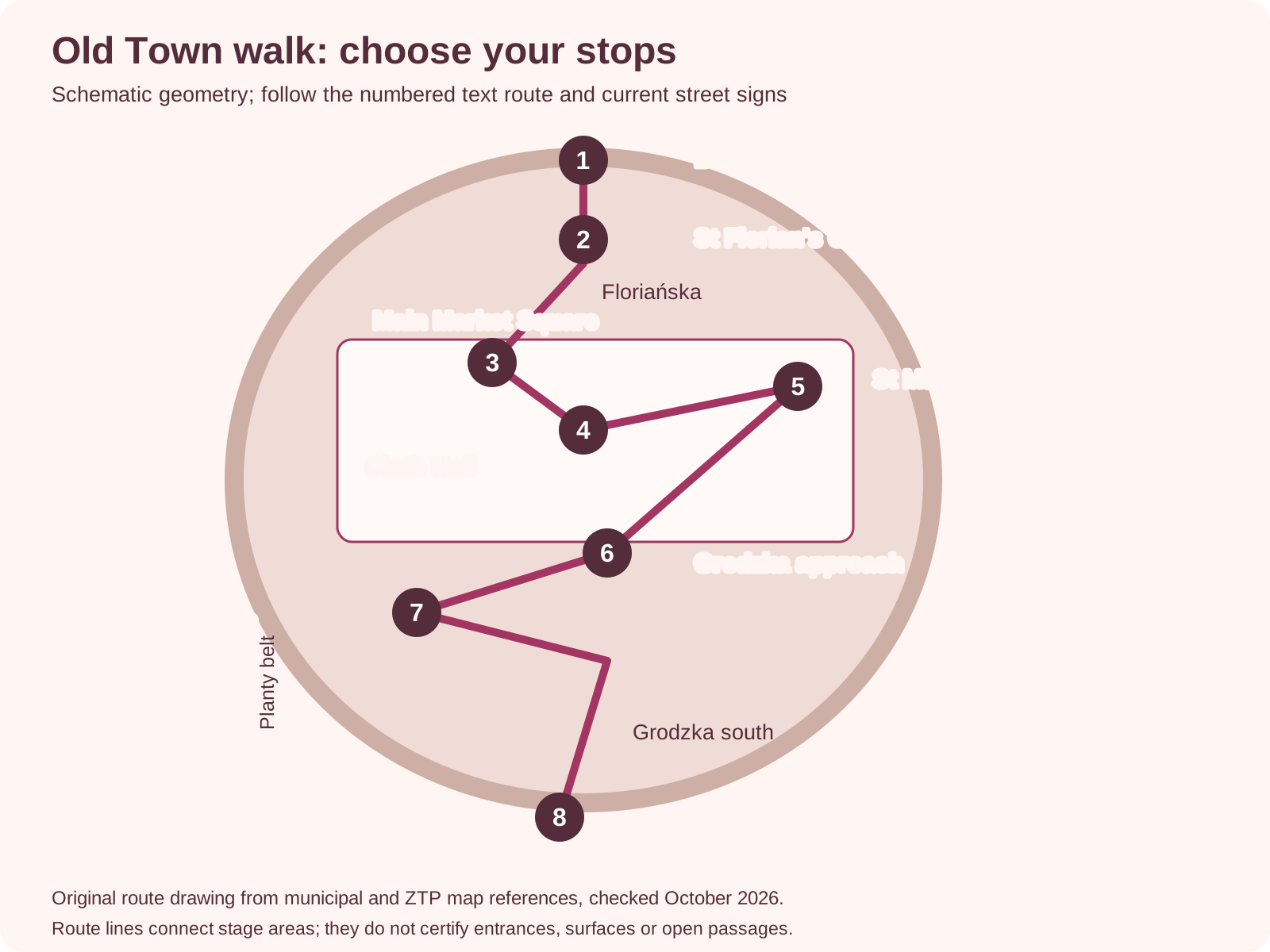
Barbican north of St Florian’s Gate; Floriańska leads to the Main Market Square. Cloth Hall is central and St Mary’s is on the eastern side. Grodzka leads south, with the Franciscan area a western branch and Wawel farther south. The full text route in the article explains the stages and separate return.
Map with a full text route below
Reference: Schematic
- Meaning
- No scale, journey time or step-free guarantee
Reference: Route use
- Meaning
- Follow the numbered text stages below
Shorter walk and breaks
Use these choices to adapt the route and keep the main visit workable. Check the current entry or journey before fixing the day.
Choices with every field
Version: Square only
- Stages to use
- 3, 4 and 5
- Best reason to choose it
- Later start or a main square-area interior
- Return decision
- Keep the route close to your room or onward journey
Version: Northern introduction
- Stages to use
- 1 through 5
- Best reason to choose it
- Gate approach and central orientation
- Return decision
- Choose an open route toward the northern edge or station side
Version: Full outline
- Stages to use
- 1 through 8
- Best reason to choose it
- A broader exterior introduction with southern choices
- Return decision
- Plan the separate journey from the Wawel finish
Krakow Travel's municipal map; ZTP's city-centre pedestrian map; Wawel Cathedral ·
Use this Krakow walking tour map for a north-to-south Old Town walk with eight numbered stages. Begin outside the Barbican, pass St Florian's Gate, follow Floriańska to the square and choose your stops there. Continue along the southern streets only if you want the Franciscan and Wawel areas. Paid interiors are choices beside the route, not automatic inclusions.
The original drawing uses Krakow Travel's municipal map and ZTP's city-centre pedestrian map. Sources were reviewed October 2026. The ZTP reference dates from 2021 and supplies street relationships only. The drawing is schematic, not to scale, with no measured distance, walking duration or certified step-free route.
The full outline links the Barbican, gate, square and southern Old Town toward Wawel. Numbers match the text stages, while entrances follow current venue rules. Shorten it to the square or northern section when that fits better.
Choose the route
Choose the full north-to-south outline if you want an outdoor introduction and can manage the onward and return journeys. Choose the square-only version if time or stamina is limited. If you reserve an interior, make its address and entry slot the day's anchor. Move the flexible walk around that booking rather than treating every numbered stage as a fixed appointment.
Use the Old Town orientation map if you need the wider relationship of Planty, the station and nearby districts. This page serves a different task: a numbered sequence through the central area. Neither drawing replaces current street signs, a venue's entrance instructions or a live transport map.
Numbered map and stop list
- Barbican: begin outside the circular fortification north of the gate area. A museum entry is a separate choice.
- St Florian's Gate: use the open public approach through the gate area toward Floriańska.
- Main Market Square: follow Floriańska into the square and pause to identify the main buildings.
- Cloth Hall: locate the hall at the square's centre. Trade stalls and the upstairs gallery are different visits.
- St Mary's: identify the church on the eastern side, then choose exterior observation or its permitted tourist entry.
- Grodzka approach: leave the square southward on the public street route toward the southern core.
- Franciscan area: take the western branch around Plac Wszystkich Świętych if this stop interests you, then return toward the southbound route.
- Wawel area: continue toward the hill using current public approaches and the entrance instructions for any booked visit.
The numbered list is the map's text equivalent. A stage is an area to identify, not a promise that a doorway is open. The drawing places the Cloth Hall and St Mary's as distinct square stops but exaggerates the connecting line to keep them legible. Choose the public walking path around the square, not a literal straight line through a building.
Start and finish
The start is the Barbican area. It can fit an approach from the northern side of the centre. Your lodging may make another beginning more useful. If you stay beside the square, start at stage three.
If you are already near Wawel, reverse the broad sequence. You do not need to travel to the first marker merely to retrace your own route.
The finish is the Wawel area, with the actual end point determined by what is open and what you choose to visit. A cathedral entry, castle exhibition and outdoor setting are separate tasks. Check your return to the room, station or parking before adding a longer stop. This is a linear outline. The route back is not included in a claimed total.
Directions between stops
From the Barbican, identify St Florian's Gate to its south. Follow the open public approach into the gate area, then Floriańska toward the square. If an access point is closed or under works, use a signed alternative. The source maps establish the relationship of these places. They do not overrule a current barrier.
In the square, use the Cloth Hall as the central reference and St Mary's as the eastern reference. Take a public path between them, giving space to other visitors and active entrances. If you want Town Hall Tower, locate it in the western part as an optional square choice. It is not an extra numbered rule on this route.
From the square, locate Grodzka leading south. At the Plac Wszystkich Świętych area, the Franciscan stop is a western choice away from the straight southward line. After that stop, return to the right public street route toward Wawel. Use a current street map if you choose smaller connecting streets. No turn-by-turn claim is made for a temporarily closed passage.
Near Wawel, follow the relevant operator's visitor instructions for the entrance you need. Wawel Cathedral and Wawel Royal Castle supply their own rules. A broad hill marker cannot identify every product entrance. Read the address and access instructions on your actual booking before continuing uphill.
The simplest shorter version begins and ends around the square. Use stages three, four and five, with a nearby seated break and one optional interior. The northern version uses stages one to five and then returns by a route that suits your destination. The southern version begins at the square and finishes where you decide the Wawel approach remains manageable.
Take a break where it supports the route you have reached. A café visit or meal needs its own current menu and available seating. We have not marked a public toilet or promised rest facility on the schematic without current operator evidence. Ask at the venue you use rather than assuming every stop offers the same facilities.
If you become tired, end the walk at the current area. An optional later stage can be left out. For a longer stay, decide how many days in Krakow will let you separate the routes. A spare day can make the southern section another outing instead of a compulsory continuation.
Surface and access cautions
Expect to judge paving, crossings and temporary works on the day. The map does not label the complete route accessible. Historic interiors and the Wawel approach have separate access questions. If avoiding steps is essential, confirm the actual venue entrance and a suitable route before fixing the visit. A broad mobility icon or old street photograph is insufficient for that decision.
For St Mary's, consult the parish visitor page. For the Franciscan interior, use the church's tourist guidance. Tourist access can pause for worship. The route remains an outdoor walk when an interior is unavailable. It does not promise access to every courtyard or grounds area.
Print the route
Print this page for the numbered list and the source notes, or open the original route drawing at full size. Keep the text list with the image so you can distinguish an area marker from an entrance. The numbers, not colour alone, identify the stages. The source and no-scale note should remain with any copy you take.
Save your actual entry and return details on its own. A printed diagram cannot update a closure or show live departures. If you prefer someone else to lead the route, compare guided and self-guided walking arrangements and use the provider's own meeting point. That guided product may follow a different sequence from this independent outline.
Route sources and corrections
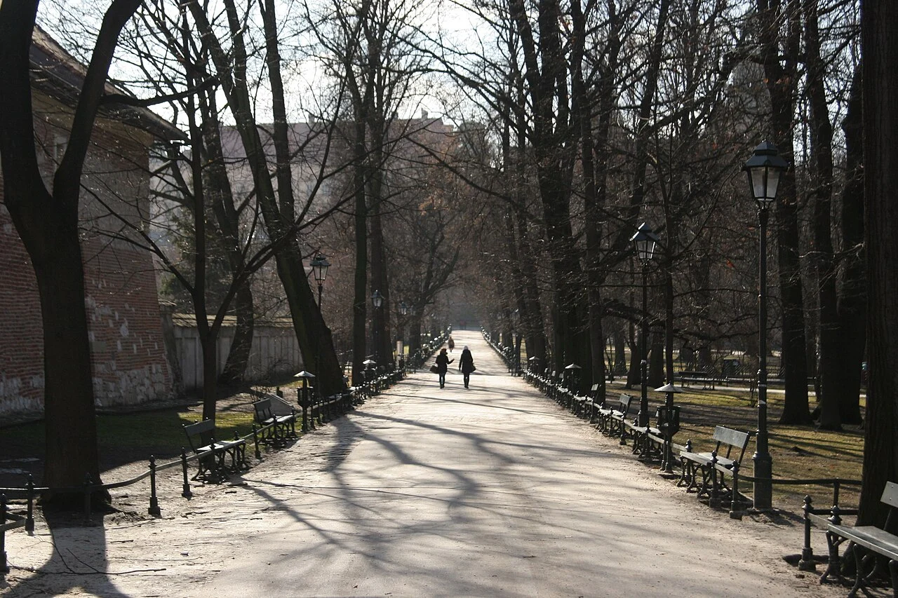
Municipal and ZTP references supply the street geometry. Venue-owned pages govern their visitor areas, checked October 2026. The numbered drawing follows the street relationships in those sources. The hero photograph shows a Planty path photographed in 2012. It is not evidence of today's surface or the complete route.
If you find a changed public connection, send the location and a primary closure notice through our contact page. Use the current signed route while a correction is assessed. A new entrance rule should be checked with the venue itself. The independent schematic is useful only when those practical limits remain clear.
Photograph: Planty Park, Krakow.jpg by Alexander Baranov from Montpellier, France, CC BY 2.0. Resized and converted to WebP; no crop.

FAQ
Is there a distance or time for the full walk?
No measured total is claimed. Stops, interiors and your return change the day. Use the numbered sequence to choose scope rather than treat it as a timed challenge.
Can I use it without entering attractions?
Yes, the outline is primarily an outdoor walk. Follow the open public paths and any current grounds rules. Paid or religious interiors remain separate choices.
Is the route a loop?
No. The full outline ends near Wawel after starting north of the square. Plan the return to your actual destination on its own.